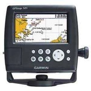
Detail Garmin GPSMap 585
Product Details
GPSMAP 585 is a full-function chart plotter that features an ultra-bright 5” WQVGA color display along with an improved feature of high-speed map drawing and panning. It’ s ready to go with an easy-to-use interface and a built-in worldwide basemap. The 585 is unique Garmin chart plotters that not only equip with English language but also with Asian languages including Simplified Chinese and Bahasa Indonesia. GPSMAP 585 is designed specifically for professional fishermen and comes with the advantages of Garmin’ s renowned GPS168/ 178C chart plotters. What’ s more, you can now fish with a high quality chart plotter at more affordable cost.
Physical & Performance:
Unit dimensions, WxHxD: 5.9" x 6.4" x 2.9" ( 15.0 x 16.3 x 7.4 cm)
Display size, WxH: 5” , 120.7x75.8mm
Display resolution, WxH: 480x272 pixels
Display type: WQVGA
Weight: 390g
Waterproof: yes ( IPX7)
Maps & Memory:
Basemap: yes
Preloaded maps: no
Ability to add maps: yes
Accepts data cards: SD card slot
Waypoints/ favorites/ locations: 6000
Routes: 150 tracks/ 250 points
Features:
CANet® compatible: no
Supports AIS ( tracks target ships' position) : yes
Supports DSC ( displays position data from DSC capable VHF radio) : yes
Audible alarms: yes
Tide tables: yes
Sun and moon information: yes
3-D map view: no
Dual-frequency sonar capable: yes
Dual-beam sonar capable : no
Split-screen zoom: yes
Split-screen sonar/ gps: yes
Ultrascroll™ ( displays fish targets at higher boat speeds) : yes
See-thru® technology ( exposes fish hidden in cover) : yes
Fish Symbol ID ( helps identify fish targets) : yes
AutoGain Technology ( minimizes clutter, maximizes targets) : yes
Whiteline ( indicates hard or soft bottom) : yes
Adjustable depth line ( measures depth of underwater objects) : yes
A-scope ( real time display of fish passing through transducer beam) : yes
Bottom lock ( shows return from the bottom up) : yes
Water temperature log and graph: yes
Water temperature sensor included: yes ( need to equipt with correct tranducer)
Sonar:
Frequency: 50/ 200 kHz
Transmit power: 500W( RMS) , 4, 000W( peak to peak)
Voltage range: 10-36 VDC
Maximum depth* : 1, 500ft
Cone angle: 20 degrees
* Depth capacity is dependent on water salinity, bottom type, and other water conditions.
What' s in the Box:
GPSMAP 585
Bail mount
Power cable
Protective front cover
Owner' s manual
Antena + Tranducer
Tampilkan Lebih Banyak